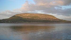
Knocknarea Mountain (Cnoc na Rí) is situated 7.5km west of Sligo Town, in the area of the Strandhill Peninsula. This breathtaking mountain dominates the skyline of Sligo town at 327m high.
Take the neatly paved path from the car park. The walk to the summit of the mountain takes an average of 40 to 45 minutes. Once you reach the top, there lies the cairn of Queen Maeve of Connacht. The cairn is about 10m high and is visible for miles around. It has not been excavated, but it is thought to cover a passage tomb similar to that of Heapstown Cairn. Queen Maeve and Knocknarea Mountain are mentioned in several of Yeats' poems and are of keen interest in Irish myth. There are spectacular views around County Sligo.
Always take care when climbing rugged or mountainous areas.
Trail details
- Type:
- Walking Trail
- Location:
- Knocknarea
- Grade:
- Strenuous
- Format:
- Linear
- Length:
- 1.20km
- Ascent:
- 200m
- Dogs allowed:
- No
Time:1.25 hours
Nearest town start:Strandhill 5km
Nearest town finish:Strandhill
Start point:Knocknarea Car Park
Finish point:Knocknarea Car Park
Waymarking:Red arrow on black background
