A-B. Starting from the first car park, enter the forestry at a wooden framed mapboard for a Sli na Slainte route. Follow the arrows on the blue disc with footprints ((and the Sli na Slainte arrows) along the forestry road for 300m to reach a T-junction where you turn right.
B-C. Another 150m takes you to a 3-way junction where you veer left and cross a small stream by a small concrete bridge.
Continue to follow the arrows on the blue discs along the forestry road for 500m to reach a crossroads with wooden signpost. Continue straight on.
C-D. Staying on the forestry road, the loop passes a number of tracks on the left before climbing gently to reach a roadway on the left on a bend. Veer right (straight) here and past a track on your right. After 250m the loop swings right and 500m further on passes straight through a crossroads.
D-E. The loop passes through a number of junctions – and at one of them merges with a Nature Trail (marked with yellow arrows and wooden Nature Point posts). Shortly afterwards the loop turns right at a 4-way junction.
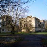
E-A. Follow the forest road as it passes through the USA Plots area. After passing a stone memorial to the Firefighters of New York killed in the 9/11 disaster, the loop turns right and emerges into a popular recreation area that contains a lake, cafe, and the ruins of Donadea Castle. The car park from which you started is only 200m from the castle.
The name Donadea derives from the Irish word ‘Domnach’ which signifies a church and also Sunday. It is believed that all churches bearing this name were founded by St. Patrick, and the foundations were marked out on a Sunday. One of the earliest references of the manor of Donadea was in connection with an inquisition taken in Cloncurry in 1312 – and in 1621, King James I created Gerald the first Baronet of Donadea! By the mid 1800’s the Donadea estates were one of the largest in Co. Kildare, amounting to almost 16,000 acres. It was around this time that extensive development occurred in the grounds surrounding the castle. The works included the construction of a stone wall surrounding almost 600 acres, the development of an artificial lake, a massive programme of tree planting within the demesne and the realignment of existing roads. In 1936 the Irish land commission acquired the lands of Donadea from the Aylmer estate. In 1981 Donadea Demesne was opened to the public and the estate is at present under the care and maintenance of Coillte (the Irish Forestry Board). This loop is one of a network of forestry trails created by Coillte as part of its Coillte Outdoors Programme. It meanders along forest roads and paths incorporating Lime Tree Avenue, and the 9/11 Memorial.
Trail details
- Type:
- Walking Trail
- Location:
- Donadea Forest Park
- Grade:
- Easy
- Format:
- Loop
- Length:
- 4.50km
- Dogs allowed:
- Yes

