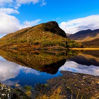
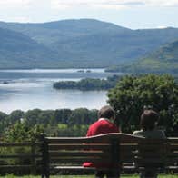
The Iveragh contains the Killarney Lakes with their mountainous backgrounds, the most famously picturesque landscapes in Ireland since tourism began in the late 1800s. The main mountain group on the peninsula, called the Macgillicuddy Reeks, contains the two highest summits in Ireland, Carrauntoohil at 1038m and Caher at 1001m.
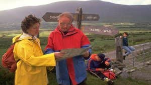
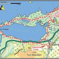
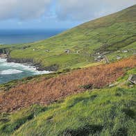
The Kerry Way, the longest of the Irish Waymarked Trails, is a circular route that circumnavigates the peninsula, starting and finishing in Killarney, and also passing through fine Kerry towns such as Glenbeigh, Caherciveen, Waterville, Sneem and Kenmare. The landscape the route passes through is very varied, from the lakes of Killarney to high and remote mountain moorland: Carrauntoohil and Caher tower over the route west of Black Valley and the return leg passes along the startlingly contrasting semi-tropical, palm-treed south coast. Terrain consists mainly of quiet tarmac roads, open moorland, woodland and field paths and boreens. Some sections of the open moorland can be very isolated, and off-road sections can often be very wet and muddy. Aggregate ascent over the whole route is about 5400m, and there are some sustained and quite steep climbs. The highest point on the Way is 385m above sea-level, at Windy Gap between Glenmore and Caherdaniel. There are some long stretches between overnight accommodation possibilities and cash machine facilities, and walkers should plan their days carefully to take these into consideration: public transport options are very good.
Maps for each section of the Kerry Way are on the Irish Trails website.
Route
Section 1 – Killarney to Galway’s Bridge/Derrycunnihy Church – Moderate
Section 2 – Galway’s Bridge/Derrycunnihy Church to Black Valley – Easy
Section 3 – Black Valley to Bridia Valley (bottom of Lack Road) – Hard
Section 4 – Bridia Valley (bottom of Lack Road) to Glencar – Hard
Section 5 – Glencar to Glenbeigh by Windy Gap – Moderate
Section 6 – Circuit of Seefin Mountain from Glenbeigh (clockwise) – Easy
Section 7 – Glenbeigh to Cahernaman (near Kells) – Easy
Section 8 – Cahernaman (near Kells) to Coars National School – Moderate
Section 9 – Cahersiveen to Gortmore – Easy
Section 10 – Coars National School to Mastergeehy – Hard
Section 11 – Mastergeehy to Waterville – Hard
Section 12 – Dromod to Road at Lough Currane – Moderate
Section 13 – Waterville to Caherdaniel – Easy
Section 14 – Caherdaniel to Esknaloughoge (N70) – Easy
Section 15 – Road at Lough Currane to Caherdaniel by Windy Gap – Hard
Section 16 – Esknaloughoge (N70) to Sneem – Easy
Section 17 – Sneem to Tahilla Post Office – Easy
Section 18 – Tahilla Post Office to Blackwater Bridge – Easy
Section 19 – Blackwater Bridge to Templenoe Post Office – Easy
Section 20 – Templenoe Post Office to Kenmare – Moderate
Section 21 – Kenmare to Galway’s Bridge/Derrycunnihy Church - Easy
Trail details
- Type:
- Long Distance Waymarked Way
- Location:
- Killarney Kenmare
- Grade:
- Strenuous
- Format:
- Loop
- Length:
- 232.10km
- Ascent:
- 5310m
- Dogs allowed:
- No
At Start - on street in Killarney or in car park (charge)
At End - beside old church at Galway's Bridge
