Howth offers visitors a myriad of attractions including Ireland’s Eye, Howth Castle, The National Transport Museum, Howth Abbey, Aideen's Grave, the Martello Tower/Ye Olde Hurdy Gurdy Museum of Vintage Radio, the Baily Lighthouse, excellent restaurants and much more.
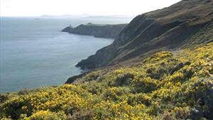
The best of all are the spectacular views from Howth Summit and the Cliff Walks, including the Black Linn Loop. This loop is one of four which starts at the DART (train) Station near the harbour. You are taken along the marina before climbing away from the village around the Nose of Howth and onto the clifftops. Take in the stunning views of Lambay Island and Ireland’s Eye, and be overwhelmed by the heady scent of coconut from the bright yellow gorse blooming on the heath. The Baily Lighthouse - the last of Ireland’s lighthouses to become automated - comes into view before you ascend to the highest point at ‘The Summit’ car park. From here you cross open hillside around the Ben of Howth and return to Howth Village via the route of the old tramline.
A-B. Starting from the DART Station follow the red arrow onto the promenade along the harbour. You are also following green, blue and purple arrows for other loops. At the end of the prom, veer right onto Balscadden Road and ascend to reach Kilrock car park from where you join the well trodden cliff path.
B-C. Follow the cliff path for approximately 3km before turning right (leaving the longer purple loop) and ascending to reach The Summit car park.
C-D. Exit the car park through the height restriction barrier and join Bailey Green Road. Follow this road downhill to reach a junction of roads at The Summit Stores and pub. Turn left here.
D-E. Follow the tarred road past The Summit Stores and, after approximately 100m, turn right onto a grassy pathway. At the end, cross Carrickbrack Road to join another pathway whcih ascends ‘Tweedy’s Hill’. Joining Windgate Road at the top of the short climb, turn right and travel for approximately 200m to reach the entrance to the hillside at a gateway on your left.
D-E. You now follow a series of paths across an open hilltop section known locally as ‘Black Linn’, where it picks up the purple loop before descending through the grounds of the local GAA Club, and eventually reaching the Balkill Park estate.
E-A. Entering Balkill Park, you pick up the green and blue loops as you join the tramline pathway. Follow the pathway downhill to exit directly opposite the DART Station - picking up the green, red and purple loops along the way.
Trail details
- Type:
- Walking Trail
- Location:
- Howth
- Grade:
- Moderate
- Format:
- Loop
- Length:
- 8.10km
- Ascent:
- 160m

