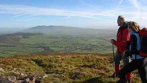
Part of the longer O’Sullivan Beara Trail, the Ballyhoura Way is a 89km waymarked trail that showcases some seriously lush landscape.
Stretching from John’s Bridge in North Cork to Limerick Junction in County Tipperary, this linear trail is fairly short and pleasantly varied. Follow it across four upland stretches, through the verdant pastureland of the Golden Vale and the wooded Ballyhoura Mountains before overlooking the gorgeous Glen of Aherlow.
Along the way you’ll admire pretty villages like Kilfinane, Ballyorgan, Ballylanders and Galbally.
Moderate underfoot, the Ballyhoura Way’s terrain mainly consists of tarmac roads, forestry tracks, open moorland and field paths. There are plenty of facilities and services near the route’s seven trailheads, should you need a break or a well-earned cup of tea.
Trail details
- Type:
- Long Distance Waymarked Way
- Location:
- St John's Bridge Limerick Junction
- Grade:
- Moderate
- Format:
- Linear
- Length:
- 89.00km
- Ascent:
- 1560m
- Dogs allowed:
- No
- Keep your eyes peeled for the ancient Norman castle at Liscarroll, this impressive 13th-century fortress still stands tall.
